ArtMaps - fun with Art and Maps
 ArtMaps is a collaboration with
Tate investigating how people relate Art to location both through an online web experience as well as through mobile applications. Initially looking at the "easy" problem of crowdsourcing location, this rapidly led to
ArtMaps is a collaboration with
Tate investigating how people relate Art to location both through an online web experience as well as through mobile applications. Initially looking at the "easy" problem of crowdsourcing location, this rapidly led to - a discussion on what we mean by location for a piece of art and
- the more general problem of crowdsourcing people's very different interpretations of the art works.
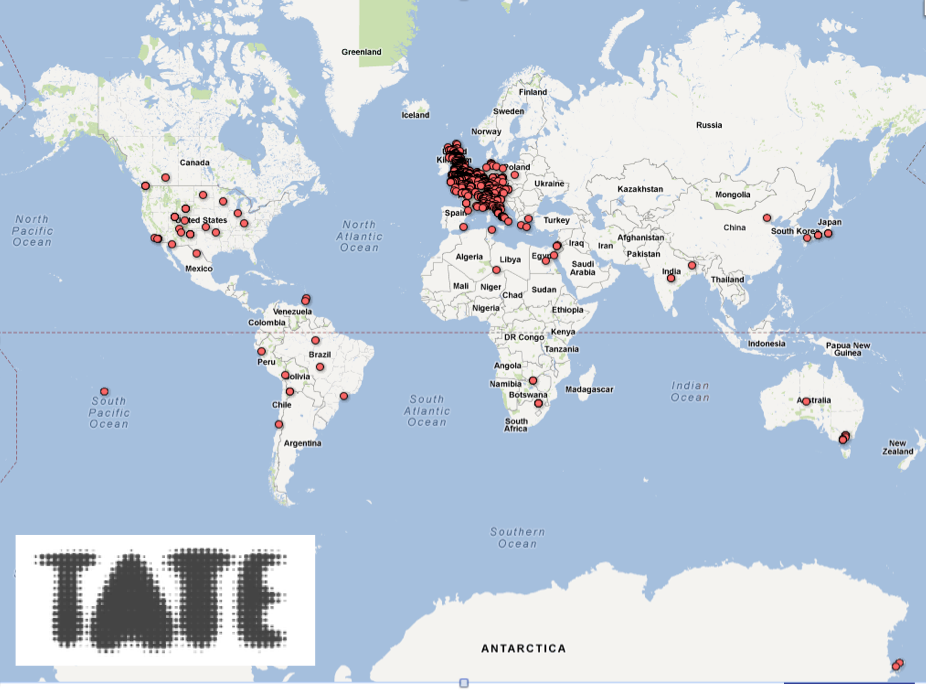
First maybe a map - here we have the Tate collection "mapped" courtesy of a Google Fusion Tables; unsurprisingly for a UK collection, UK and Europe feature heavily, but we find a range of artworks from across the world - yes that is McMurdo base in Antarctica. The location as longitude and latitude was obtained by looking up the place names that curators had associated with each artwork - but if all you have is India, you get N 20° 0' 0'' E 77° 0' 0''... So clearly some crowdsourcing to achieve more accurate location would be handy; in order to instill a sense of anticipation, more on that later.
Initially this gnarly handed engineer was somewhat flummoxed by all this talk of artistic interpretation but I think we've got to grips with some of the issues in terms of how we can design some technological systems to assist. Fundamentally, while some of the aspects of the meta data you might want to crowdsource could be defined by a schema, the different interpretations may in fact essentially define their own... colleagues in Art and Humanities have now educated me to understand this divergence and heterogeneity is to be encouraged and embraced.
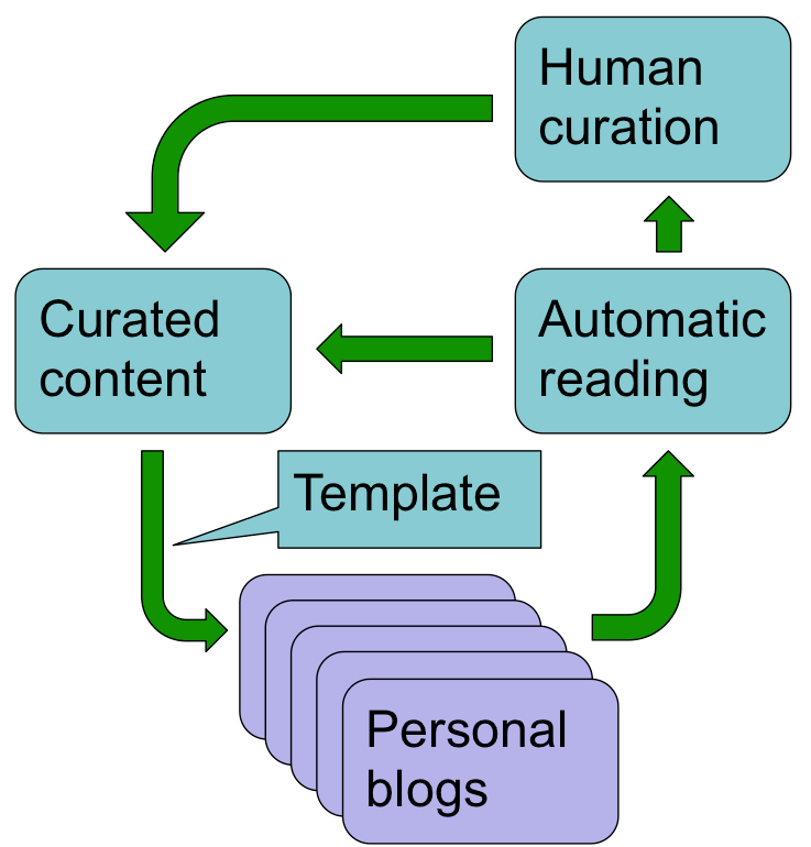 At this point one could revert to good old text processing and "big data" techniques, but by the introduction of a modest amount of structure, we could at least link what people are saying to what they are talking about.
 The design is simple and uses "semi-structured" blogs - we start with curated content about which we seek information with each participant using a blog to make their contributions. After navigating around some content, if the contributor wishes to add to the discussion they are taken to their blog where a post has been partly constructed from a template supplied by the content curator, containing links to the original content (indeed any meta data desired can be buried in the template) and fields for them to add structured information (like location). They are then free to comment further and add images etc as they would a normal blog post.
Once posted a blog-ping is sent to the content curator website, and it is free to parse and process the blog content - importantly, not only do we know what is being talked about, the structured content is amenable to automated processing and only finally do we invoke processing of the unstructured content.
Since each blog post is "self describing", one blog can be used to comment on many different collections using different templates, with each content provider being able to identify their own.
So far so good, but to return to this "simple" issue of location. It was minutes into the first meeting before the discussion moved from the comparatively simple "do we mean where the artist sat" or "the location of the subject", to "where it has been displayed", "where the artist lived at the time", etc.
 All these I can see applying some simple processing and starting to form density maps of suggested locations (and dates) which could eventually provide enough evidence to change the curated content. However, finally we got to the challenging ones "where do you think of when you see this Kandinsky"...
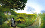
The abstract is one challenge, but what about that currently topical location of Hobbiton? Plenty of maps, but has anyone got longitube and latitude sorted out for Middle Earth?
Once posted a blog-ping is sent to the content curator website, and it is free to parse and process the blog content - importantly, not only do we know what is being talked about, the structured content is amenable to automated processing and only finally do we invoke processing of the unstructured content.
Since each blog post is "self describing", one blog can be used to comment on many different collections using different templates, with each content provider being able to identify their own.
So far so good, but to return to this "simple" issue of location. It was minutes into the first meeting before the discussion moved from the comparatively simple "do we mean where the artist sat" or "the location of the subject", to "where it has been displayed", "where the artist lived at the time", etc.
All these I can see applying some simple processing and starting to form density maps of suggested locations (and dates) which could eventually provide enough evidence to change the curated content. However, finally we got to the challenging ones "where do you think of when you see this Kandinsky"...The abstract is one challenge, but what about that currently topical location of Hobbiton? Plenty of maps, but has anyone got longitube and latitude sorted out for Middle Earth?
Written on July 9, 2012